Hai perso la password? Nuovo utente? Registra
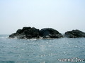
Clownfish, Philippines. Photo by Stephane Rochon.
Divertiti e contribuisci!
| Trova il miglior sito d'immersione |
|
|
 India
India
Asia
Posizione: Southern Asia, bordering the Arabian Sea and the Bay of Bengal, between Burma and Pakistan
Coordinate geografiche: 20° 0' N, 77° 0' E
Linea di costa km: 7,000 km km
Clima: varies from tropical monsoon in south to temperate in north
Terreno: upland plain (Deccan Plateau) in south, flat to rolling plain along the Ganges, deserts in west, Himalayas in north
Altitudine:
Pericoli naturali: droughts; flash floods, as well as widespread and destructive flooding from monsoonal rains; severe thunderstorms; earthquakes
Valuta: Indian rupee (INR)
Popolazione:
Lingue: English enjoys associate status but is the most important language for national, political, and commercial communication; Hindi is the national language and primary tongue of 30% of the people
Capitale:
Divisioni:
maggiori dettagli
| Jan | Feb | Mar | Apr | May | Jun | Jul | Aug | Sep | Oct | Nov | Dec | |
|---|---|---|---|---|---|---|---|---|---|---|---|---|
| Climate | ||||||||||||
| Air temp. | ||||||||||||
| Water temp. | ||||||||||||
| Equipment | ||||||||||||
| Best season | ||||||||||||
Vuoi inserire alcune informazioni su India? Faccelo sapere
Questa è una mappa interattiva! usa i controlli zoom e pan.
- registro delle immersioni (4)
- viaggi (1)
- Foto (12)
- Video (0)
- Condividi
- Preferito
-
Lista dei tuoi punti d'immersione preferiti e futuri
La tua zona preferita non è nell'elenco? Aggiungi una zona
Zone
| Zone (3) | Siti d'immersione | Sotto zone |
|---|---|---|
| Andaman Islands | 2 | 0 |
| Goa | 3 | 0 |
| South India | 2 | 1 |


 Dive logs
|
Viaggi subacquei
|
Commenti
Sii il primo a commentare questo paese
Errori, Segnalazione
Se vuoi aggiungere altre informazioni o hai riscontrato degli errori per questo Stato, Scrivi una recensione.
Pubblicità
Wannadive.net 24/24
Wannadive.net sul tuo telefono
![]()
RSS Tutti i RSS feeds di Wannadive.net
Newsletter Tutte le notizie per email