Hai perso la password? Nuovo utente? Registra
Whale Shark, Philippines. Photo by Stephane Rochon.
Divertiti e contribuisci!
| Trova il miglior sito d'immersione |
|
|
 Haiti and Navassa
America Centrale
Posizione: Caribbean, western one-third of the island of Hispaniola, between the Caribbean Sea and the North Atlantic Ocean, west of the Dominican Republic.
Coordinate geografiche: 19° 0' N, 72° 15' W
Linea di costa km: 1,771 km km
Clima: tropical; semiarid where mountains in east cut off trade winds. Summer Max: 37°C (98°F); Summer Min: 29°C (84°F); Winter Max: 21°C (71°F); Winter Min: 17°C (62°F)
Terreno: mostly rough and mountainous
Altitudine: lowest point: Caribbean Sea 0 m
highest point: Chaine de la Selle 2,680 m
Pericoli naturali: lies in the middle of the hurricane belt and subject to severe storms from June to October; occasional flooding and earthquakes; periodic droughts
Valuta: gourdes (HTG)
Popolazione: 9,035,536 (July 2010)
Lingue: French Creole, English, Spanish
Capitale: Port-au-Prince
Divisioni: 10 departments (departements, singular - departement); Artibonite, Centre, Grand 'Anse, Nippes, Nord, Nord-Est, Nord-Ouest, Ouest, Sud, Sud-Est
maggiori dettagli
| Jan | Feb | Mar | Apr | May | Jun | Jul | Aug | Sep | Oct | Nov | Dec | |
|---|---|---|---|---|---|---|---|---|---|---|---|---|
| Climate | ||||||||||||
| Air temp. | ||||||||||||
| Water temp. | ||||||||||||
| Equipment | Nie wiem | Nie wiem | Nie wiem | Nie wiem | Nie wiem | Nie wiem | Nie wiem | Nie wiem | Nie wiem | Nie wiem | Nie wiem | Nie wiem |
| Best season | ||||||||||||
Vuoi inserire alcune informazioni su Haiti and Navassa? Faccelo sapere
Questa è una mappa interattiva! usa i controlli zoom e pan.
- registro delle immersioni (0)
- viaggi (0)
- Foto (118)
- Video (0)
- Condividi
- Preferito
-
Lista dei tuoi punti d'immersione preferiti e futuri
Siti d'immersione
| Siti d'immersione (20) | Qualità | Profondità media | Profondità massima | Esperienza | Tipo d'immersione | ||
|---|---|---|---|---|---|---|---|
| Cachal Point | 6 / - | 39.4 ft | 65.6 ft | CMAS ** / AOW | 

|
||
| Cachal Reef | 3 / - | 32.8 ft | 59.1 ft | CMAS * / OW |
|
||
| Caracol Barrier Reef | 6 / - | 39.4 ft | 65.6 ft | CMAS ** / AOW |
|
||
| Chouchou Bay | 2 / - | 32.8 ft | 49.2 ft | CMAS * / OW | 
|
||
| Clover Leaf | 3 / - | 32.8 ft | 65.6 ft | Tutti i subacquei |

|
||
| East Wall - Islet de Bas-Limbe | 6 / - | 29.5 ft | 39.4 ft | CMAS ** / AOW |
|
||
| Fort Labouque | 5 / - | 32.8 ft | 49.2 ft | CMAS ** / AOW |
|
||
| Iles des Arcadins | 25 / - | 32.8 ft | 65.6 ft | Tutti i subacquei |
|
||
| Isla Amiga | 3 / - | 39.4 ft | 65.6 ft | Tutti i subacquei |
|
||
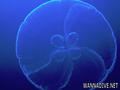
| Jellyfish - 50 Turquoise Shoals | 6 / - | 32.8 ft | 49.2 ft | Tutti i subacquei |
|
||
| Lemon Beach | 6 / - | 32.8 ft | 65.6 ft | Tutti i subacquei |
|
||
| Liberty Wall | 9 / - | 65.6 ft | 131.2 ft | CMAS * / OW |

|
||
| Paradise Beach | 3 / - | ft | ft | Tutti i subacquei |
|
||
| Powder Beach Reef | 6 / - | 49.2 ft | 82 ft | CMAS * / OW |
|
||
| Rock Steps | 6 / - | 32.8 ft | 49.2 ft | Tutti i subacquei |
|
||
| Saint Marc Beach | 12 / - | 59.1 ft | 656.2 ft | Tutti i subacquei | 
|
||
| Tear Drops - 50 Turquoise Shoals | - / - | 32.8 ft | 39.4 ft | Tutti i subacquei |
|
||
| The Cut - 50 Turquoise Shoals | 5 / - | 26.2 ft | 36.1 ft | Tutti i subacquei |
|
||
| The Rust Bucket | 3 / - | 32.8 ft | 65.6 ft | Tutti i subacquei |
|
||
| Trois Maries | 3 / - | 49.2 ft | 98.4 ft | CMAS ** / AOW |
|
 Foto
Foto

Cachal Point |
Cachal Point |
Cachal Point |
Cachal Point |
Commenti
Errori, Segnalazione
Se vuoi aggiungere altre informazioni o hai riscontrato degli errori per questo Stato, Scrivi una recensione.
Pubblicità
Wannadive.net 24/24
Wannadive.net sul tuo telefono
![]()
RSS Tutti i RSS feeds di Wannadive.net
Newsletter Tutte le notizie per email